LI956
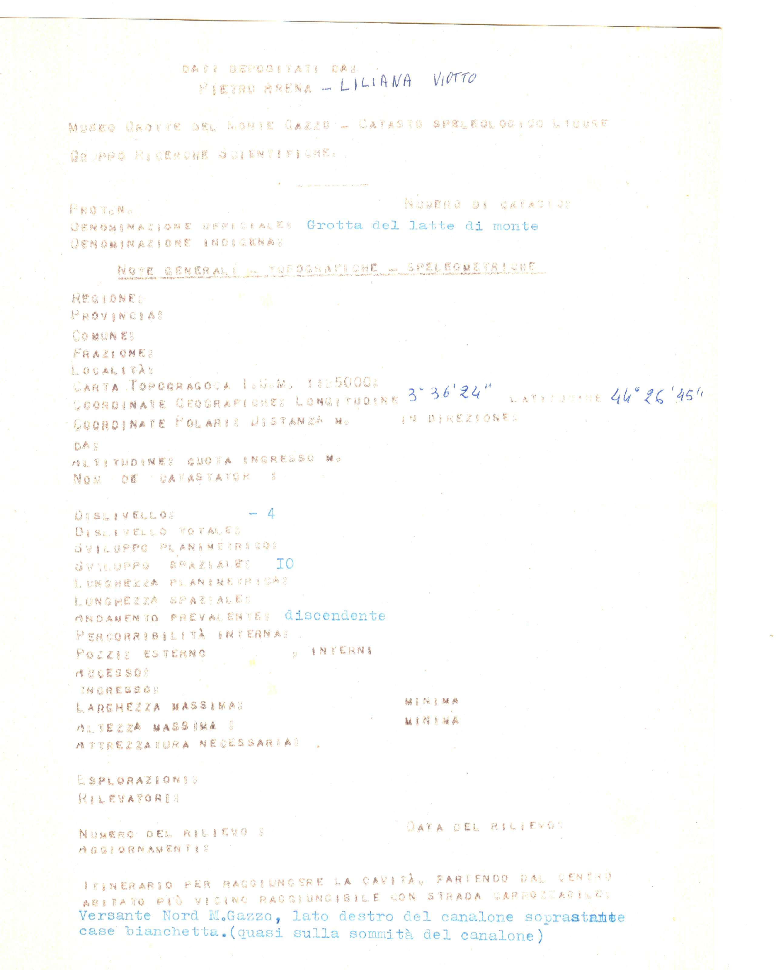
GROTTA DEL LATTE DI MONTE
Firstreference
ARENA PIERO, LILIANA VIOTTO
Regione
LIGURIA
Provincia
GE
Comune
GENOVA
Localita
SESTRI P.
Areas
Size
Lenght total
10
Depth positive
0
Depth negative
4
Depth total
4
Entrance location
Latitude
44°26'45'' N
Longitude
3°36'24'' Ovest di Monte Mario
Coordinates type
IGM 1:25000 Geografiche M.Mario (OVEST)
Original coordinates type
IGM 1:25000 Geografiche M.Mario (OVEST)
Elevation
310
Elevation gps
0
Location evaluation
dati aprossimati
Archeological
No
Marine
No
Environmentalrisk
No
Destroyed
Partially
Associations
GRUPPO RICERCHE SCIENTIFICHE STALATTITE
Notes
ad ora non è stato possibile identificare l'ingresso della grotta
Itinerary
Versante Nord M.Gazzo, lato destro del canalone soprastante case bianchetta.(Quasi sulla sommità del canalone).
Parzialmente distrutta da lavori in cava.
Parzialmente distrutta da lavori in cava.
Import rawdata
1{_"REGIONE":"LI","PROV":"GE","NUM":"956","SPECIF":"1","DATAGG":null,"DRILEV":"1987-12-31","NOME":"GROTTA DEL LATTE DI MONTE","SINON":null,"RAS":"N","COMUNE":"GENOVA","LOCAL":"SESTRI P.","ACAR":"MONTE GAZZO","ACARCOD":"GE33","FM":null,"FMCOD":null,"AGE":null,"SVILRE":"10","SVILPLAN":null,"ESTEN":null,"DPOS":"0","DNEG":"4","DTOT":"4","TC_01":"IGM 1:25000 Geografiche M.Mario (OVEST)","latitude":"44\u00b026'45'' N","longitude":"3\u00b036'24'' Ovest di Monte Mario","DC_01":"82 II NE SESTRI PONENTE","SC_01":null,"AE_01":"0","QA_01":"310","QC_01":null,"VD_01":"dati aprossimati","IDRO":null,"RILEVATORI":"ARENA PIERO, LILIANA VIOTTO","GRADORIL":null,"GRUPPI":"GRUPPO RICERCHE SCIENTIFICHE STALATTITE","NOTE":null,"NOTE2":"ad ora non \u00e8 stato possibile identificare l'ingresso della grotta","RCS":null,"ITINERARIO":"Versante Nord M.Gazzo, lato destro del canalone soprastante case bianchetta.(Quasi sulla sommit\u00e0 del canalone).\r\nParzialmente distrutta da lavori in cava.","recordinsert":"2010-07-10 01:32:04","recordupdate":"2017-02-04 19:37:16","username":"admin","userupdate":"alessandrovernassa","marina":"N","archeologica":"N","rischioambientale":"N","chiusa":"N","distrutta":"P","data_verifica":null}
Dati compilazione
Recordinsert
10/07/2010
Username
admin
Userupdate
alessandrovernassa
Recordupdate
04/02/2017
Coordinate WGS84 (Lon,Lat):
Coordinate WGS84 (Lon,Lat):
Coordinate WGS84 UTM (x,y,zone):
Schede storiche Issel:


Genera scheda catastale
Download update form